

Geography & Planning
Mangwe District Maps
Explore the official planning maps for Mangwe District. Click any map to view it full-size, or download the high-resolution PDF.
 View full size
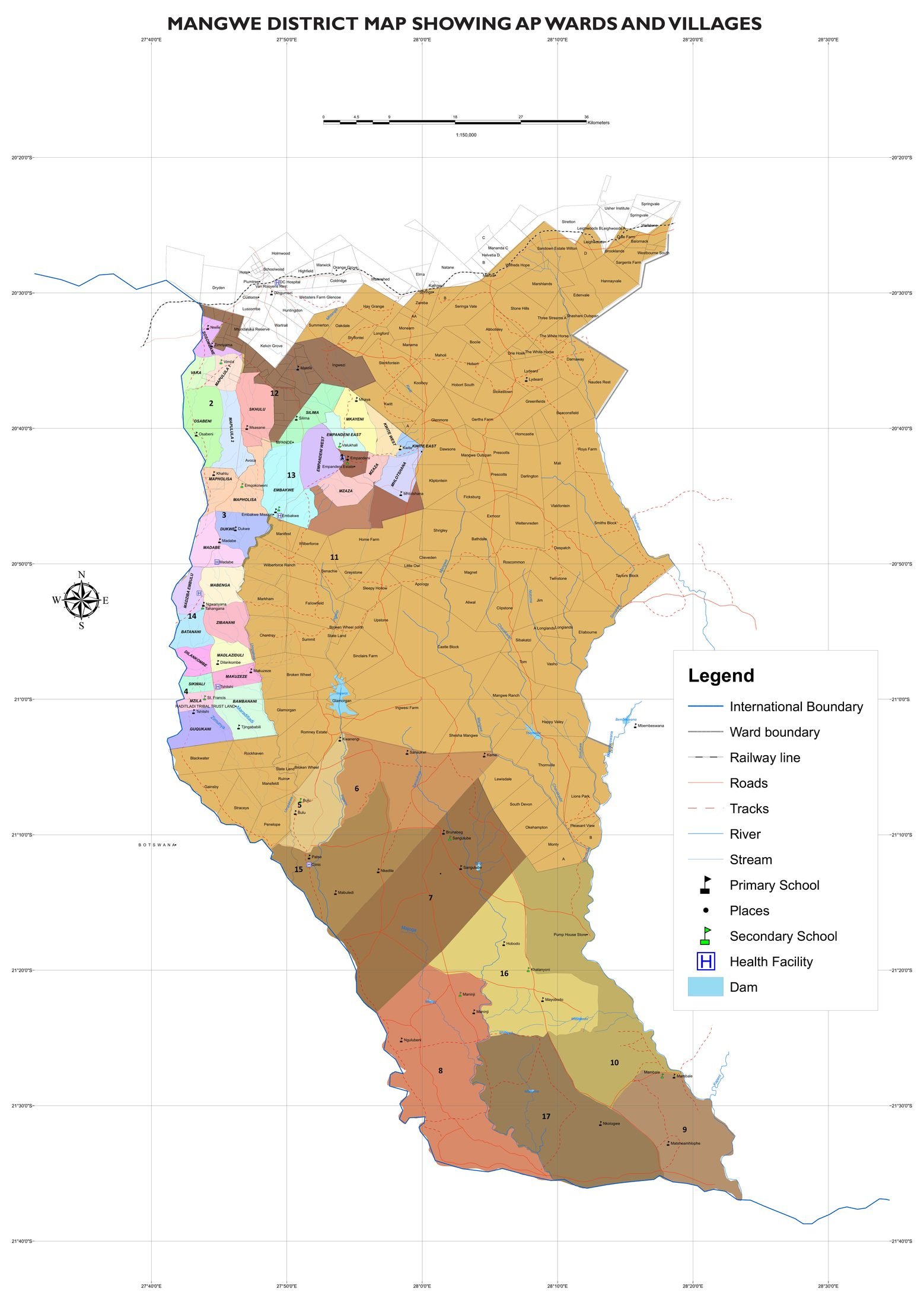
Wards & Villages Map
The administrative map of Mangwe District showing all 17 wards, villages, boundaries, roads, rivers, schools and health facilities.
 View full size
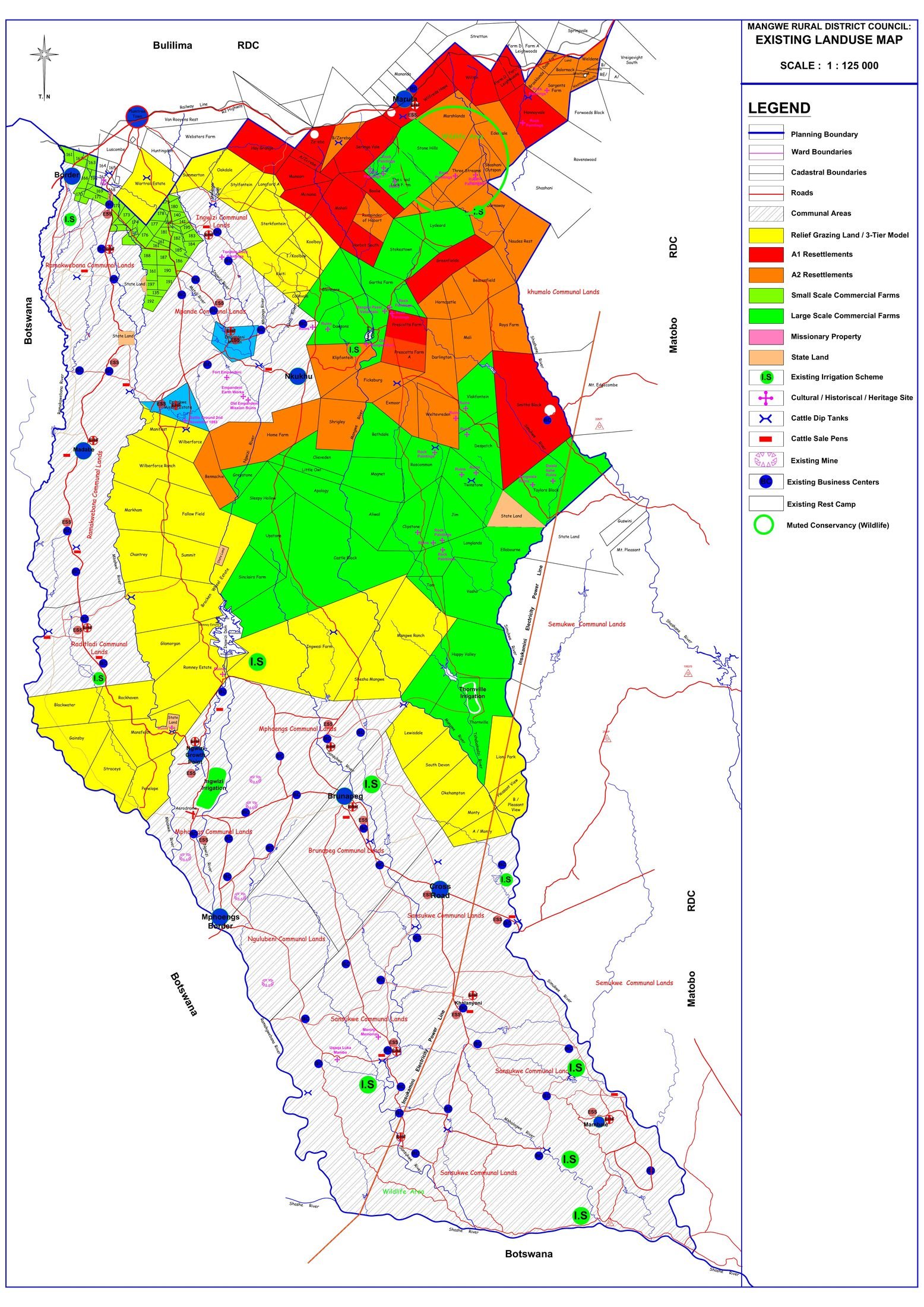
Existing Land-Use Plan
The existing land-use map covering communal areas, commercial farms, resettlements, state land, conservancies, irrigation schemes and infrastructure across the district.
 View full size
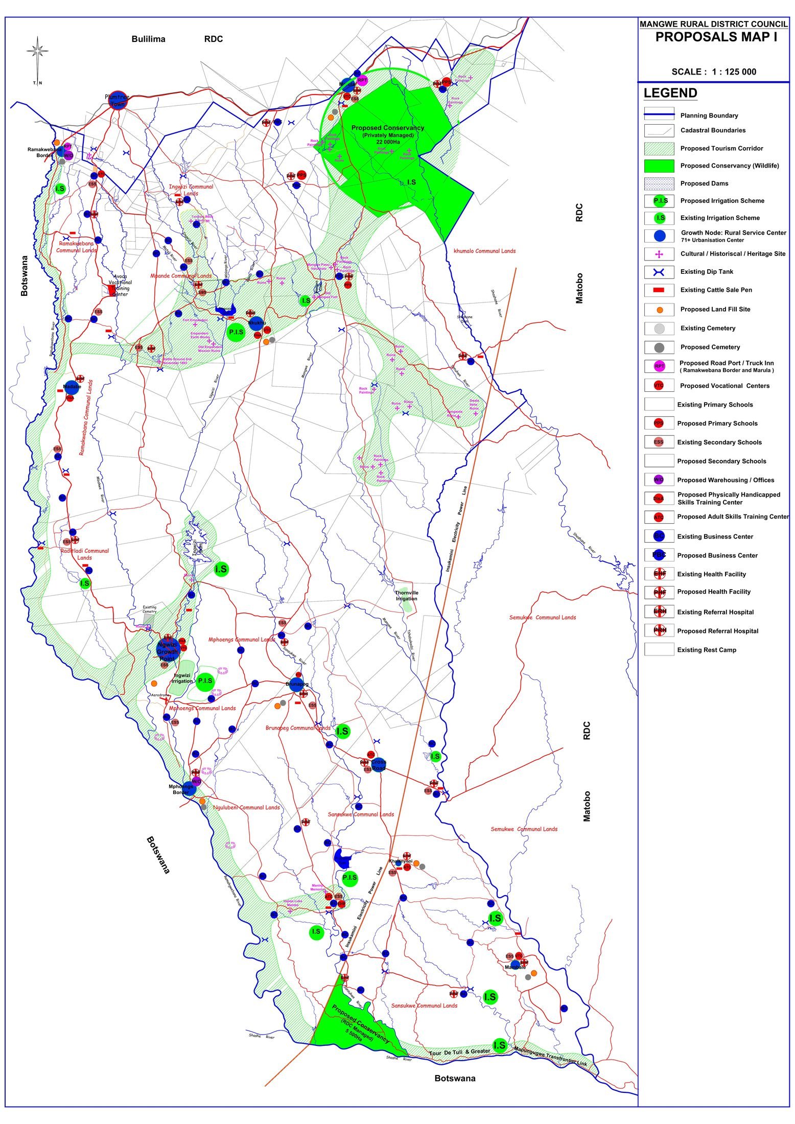
Tourism & Development Proposals Map
The proposals map highlighting the tourism corridor, proposed conservancies, heritage and cultural sites, dams, irrigation schemes and proposed social-service facilities.
These maps are produced for planning and information purposes. For certified or survey-grade documents, please contact our offices.